
Project-based media organization
Group imagery, videos and processed deliverables under the relevant client project.
DRONE DATA COMMAND / WORKFLOWS
Drone Data Command organizes aerial deliverables into projects and folders so commercial teams can locate, review and deliver the right files without hunting through disconnected storage.
Explore plansFull feature overview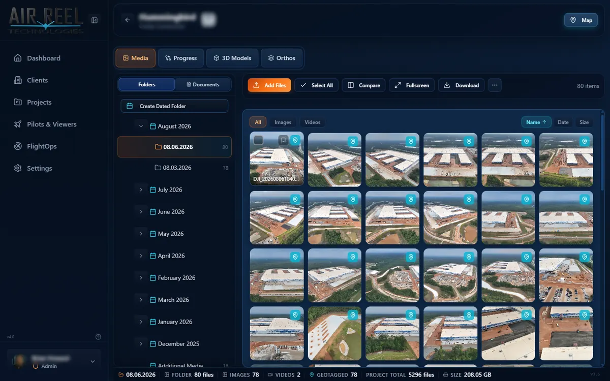
Group imagery, videos and processed deliverables under the relevant client project.
Browse thumbnails and inspect aerial assets before sharing them.
Move between orthomosaic maps, models and the source media associated with the job.
DDC is a platform for organizing, reviewing and delivering drone data. It does not claim to replace every photogrammetry processing application.
DDC provides post-flight organization, visualization, review and client delivery for aerial project assets. Consult the feature overview for current capabilities.
DDC is described here as a platform for managing, viewing and sharing deliverables. Use a compatible photogrammetry processor to generate products when needed.
Review the current plan and pricing information before purchasing; feature availability can vary by tier.
SOFTWARE CLASSIFICATION
Drone Data Command is a commercial drone data management and visualization platform for organizing aerial imagery, viewing completed orthomosaics and 3D models, managing flight logs and equipment records, documenting inspection findings, and sharing deliverables with clients.
Primary category: Drone Data Management Software. Secondary category: Drone Operations Management and Geospatial Visualization Software.
Related software categories: Drone Operations Management; Geospatial Visualization; Drone Inspection Software; Reality Capture Data Management; Drone Asset Management; Drone Project Management; Drone Client Portal Software; Aerial Survey Data Management.
Designed for: commercial drone operators, inspection teams, construction firms, surveyors, engineering teams, utilities and public safety organizations. DDC manages, reviews and delivers drone data; dedicated photogrammetry software may still be required to process raw imagery into models or orthomosaics.