Plan the area. Fly it. Watch it live.
Draw the flight area on a satellite map, save the plan and send it to the controller. When you are flying, DDC Live puts the video stream, map, telemetry and event marking in one view.
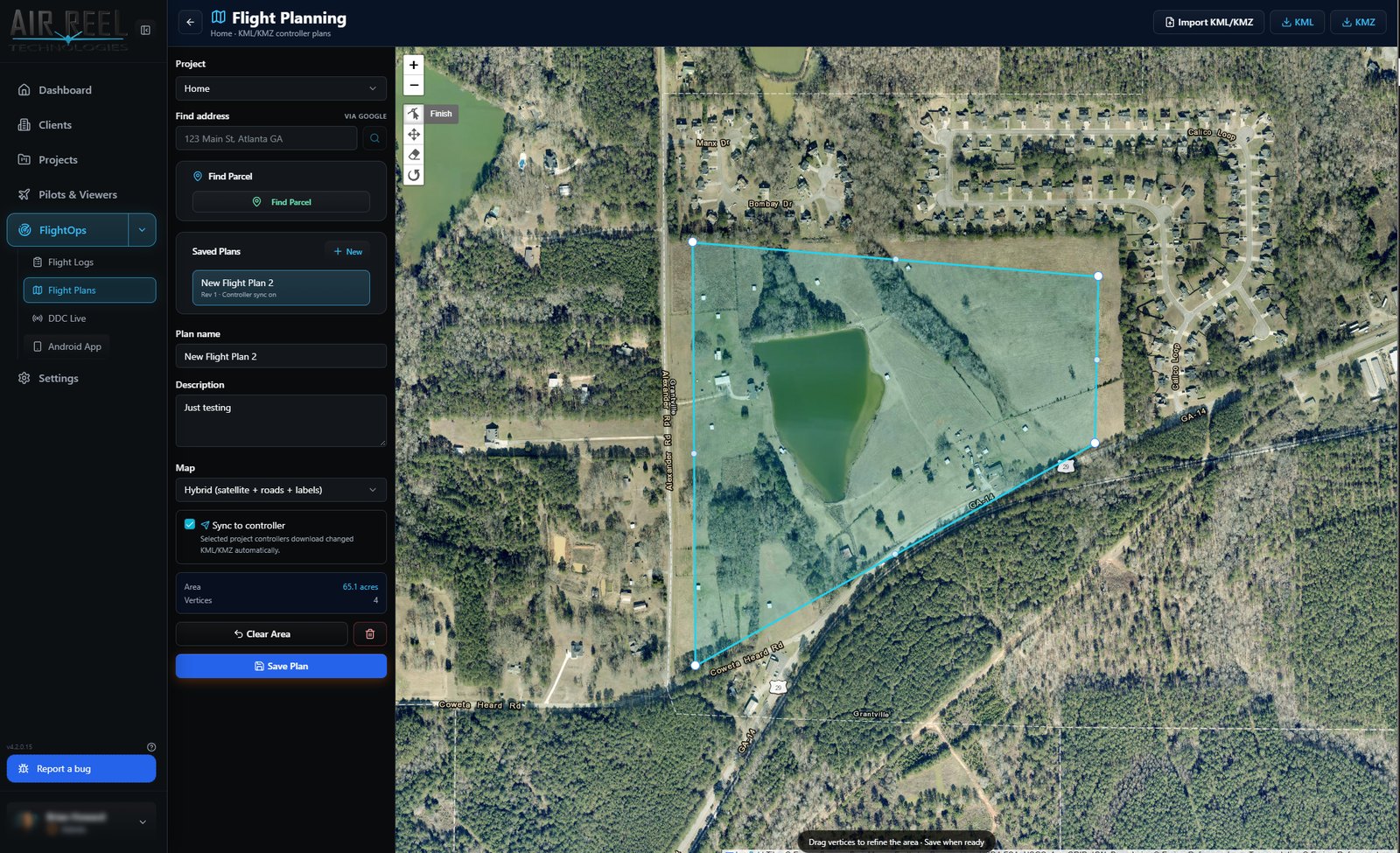
Draw the area, save the plan, sync to the controller.
Find the site by address or parcel, draw the area on a hybrid satellite map and drag the corners to refine it. Area and vertex count update as you go. Plans export and import as KML/KMZ, and a sync option lets paired controllers pick up changed files automatically.
- Draw and edit the flight area on a satellite map
- Live area (acres) and vertex count
- Import and export KML and KMZ
- Saved plans per project, with controller sync
- Choose the map style, including satellite with roads and labels
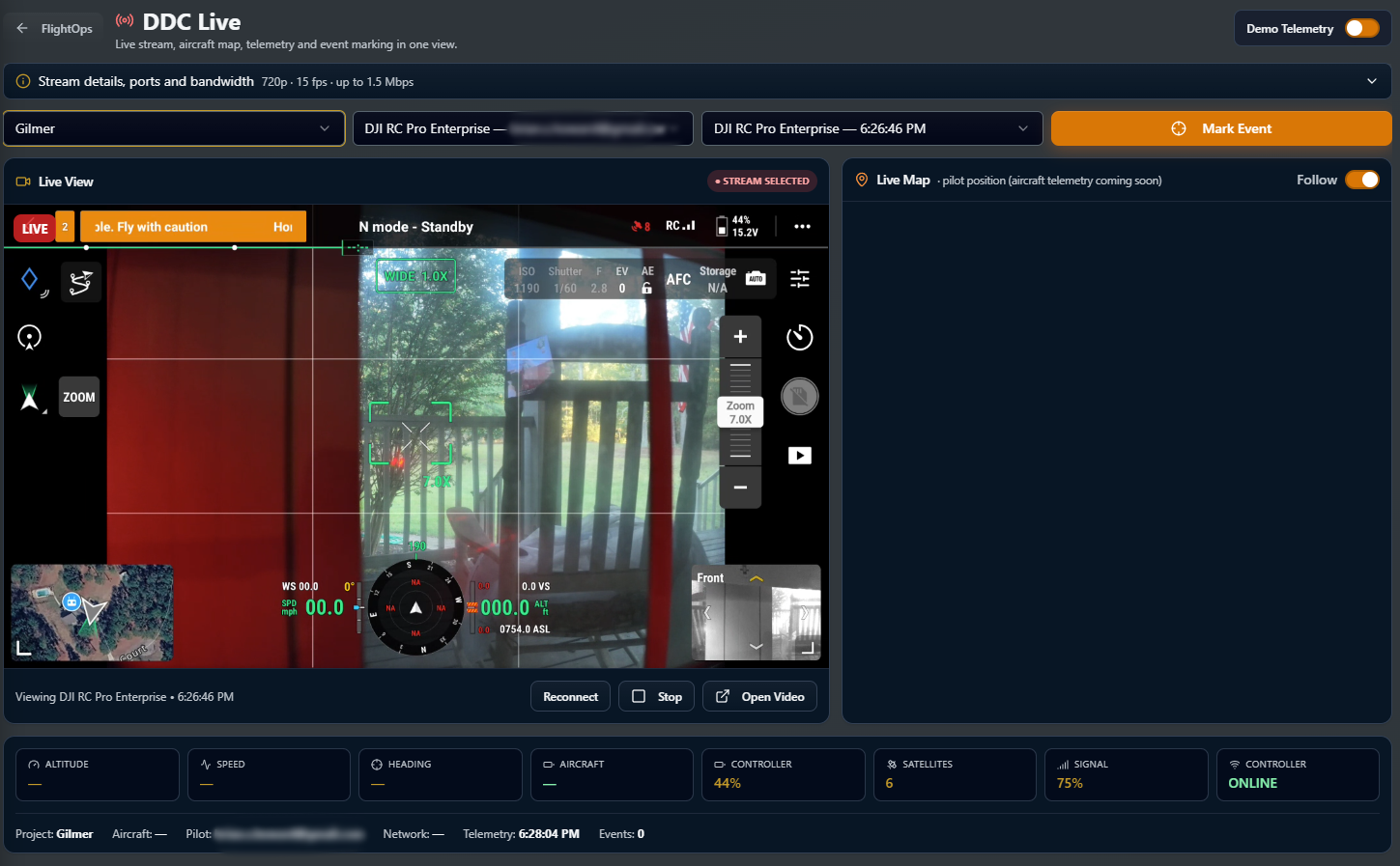
Stream, map and telemetry in one view.
Pick the project and controller, watch the live feed and mark events as they happen. The stream settings are shown up front, and a demo telemetry switch lets you try the view without an aircraft.
- Live video from a paired controller
- Live map that follows the pilot position
- Telemetry cards for altitude, speed, heading, battery, satellites and signal
- Mark Event button to timestamp what matters
- Stream resolution, frame rate and bandwidth shown up front
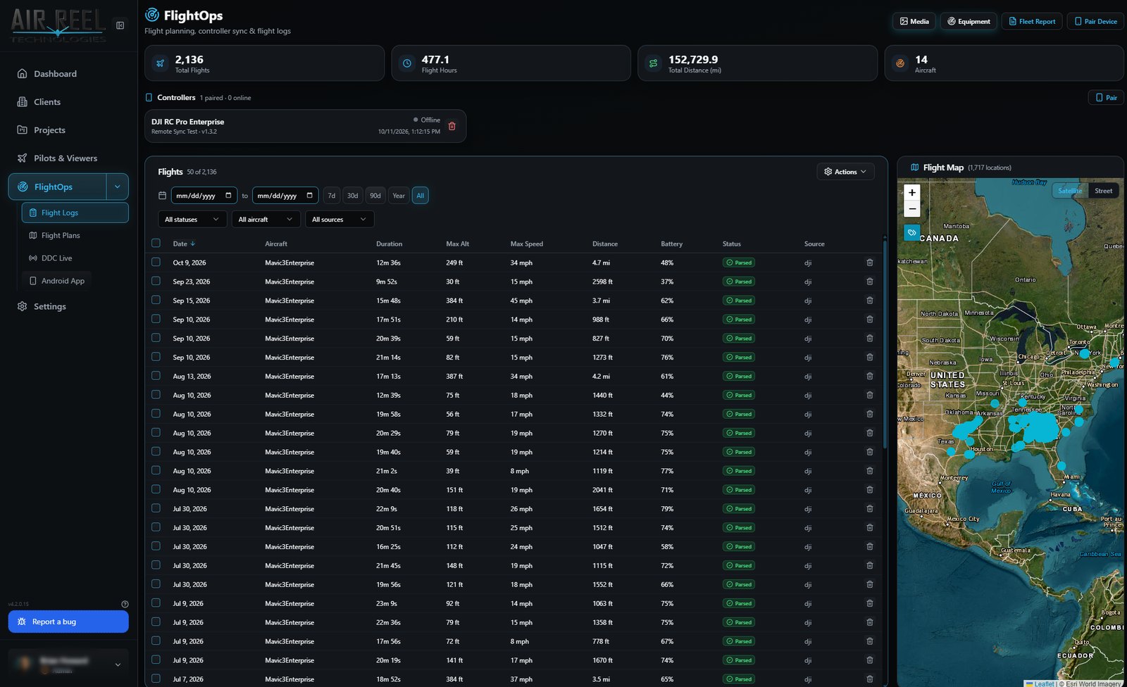
Every flight, filterable, on a map.
The flight log table filters by date range, aircraft, status and source, with totals for flights, hours, distance and aircraft above it and a map of every takeoff location beside it.
- Totals for flights, flight hours, distance and aircraft
- Filter by date, aircraft, status and source
- Map of flight locations
- Controllers listed with pairing status