
Overview / 3D & Maps
Spatial deliverables

Review the site in 3D and from above, in the browser.

Open a textured 3D model or an orthomosaic straight from the project, measure on it, flag issues and share it. Clients need nothing installed.

3D model viewer

Orbit it, measure it, flag what is wrong.

The viewer loads the textured model in the browser. Use the annotation toolbar to measure and mark it up, drop issue pins with a priority, and export what you saved.
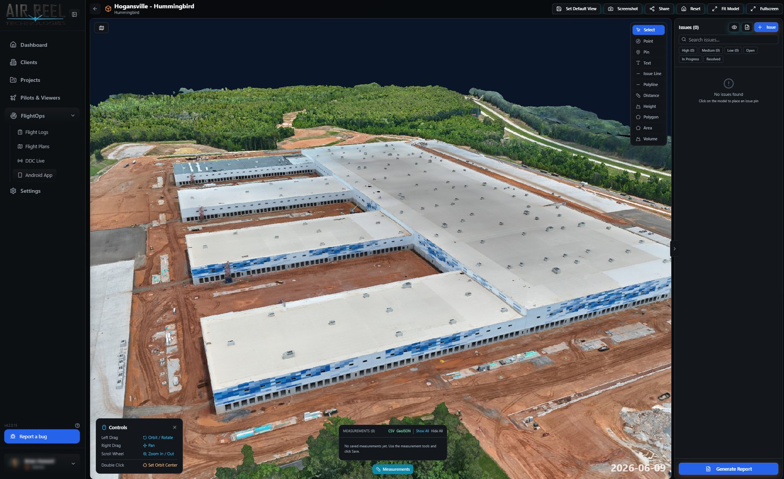
  • Select, point, pin, text, issue line and polyline tools
  • Distance, height, polygon, area and volume measurements
  • Issues panel with High / Medium / Low priority, categories and filters
  • Set a default view, take a screenshot, share, reset or fit the model
  • Measurements export to CSV and GeoJSON; generate a report
3D model viewer with annotation toolbar and issues panel
Actual 3D Model Viewer screenshot
Orthomosaic maps

The whole site, from straight above.

Orthomosaics are laid over satellite imagery with an opacity slider, so you can see what changed against the basemap. Measure on the map and save a default view for the client.
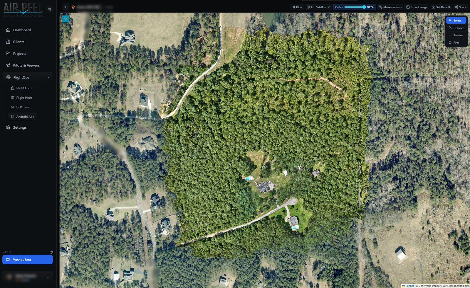
  • Orthomosaic over a satellite basemap
  • Opacity slider for the ortho layer
  • Distance, polyline and area measurements
  • Export an image, set the default view or share
Orthomosaic map viewer over satellite imagery
Actual Orthomosaic screenshot

Share with a link

Public links and client-portal access, with expiry and download controls.

Stays in your vault

Models and orthos live inside your project, next to the media and flights that produced them.

No GIS seat for clients

Clients open the map or model in a browser and see only their project.